UNO Aviation Students Gain Hands-On Experience in Drone Operations Lab
- published: 2026/03/13
- contact: UNO Aviation Institute
- phone: 402.554.3424
- email: aviationuno@unomaha.edu
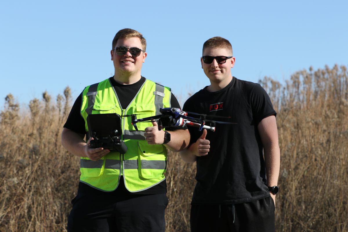
Students in the AVN 2500 Unmanned Aircraft Systems Flight Operations course at the University of Nebraska at Omaha (UNO)Aviation Institute recently completed a hands-on drone lab designed to simulate the real-world processes used in professional unmanned aircraft operations.
The lab provides students with the opportunity to apply classroom knowledge in a practical environment while working with industry-standard drone technology. Throughout the exercise, students strengthened their operational and technical skills while learning how unmanned aircraft are used to collect and analyze aerial data.
The course is taught by Assistant Professor Haoruo Fu, whose research focuses on aviation safety, geospatial data analysis, and systems risk analysis. Fu earned his bachelor’s degree in Aeronautical Science and his master’s degree in Applied Aviation Safety from the Florida Institute of Technology before completing his Ph.D. in the School of Aviation and Transportation Technology at Purdue University. In addition to teaching courses related to UAS operations and capstone research projects, Fu studies topics such as wildlife hazards at airports, airport operational safety, and transportation risk modeling.
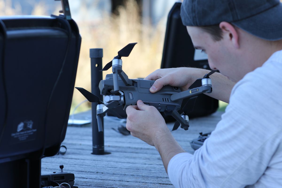
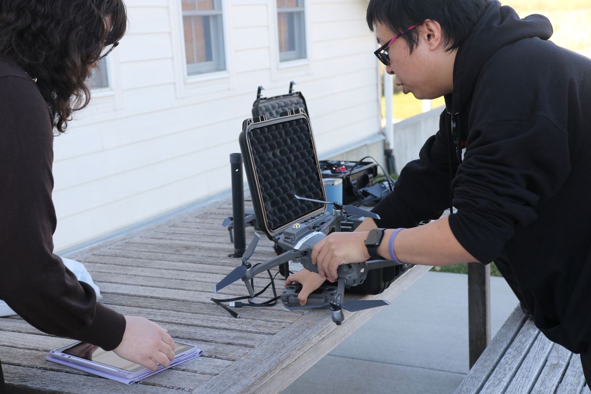
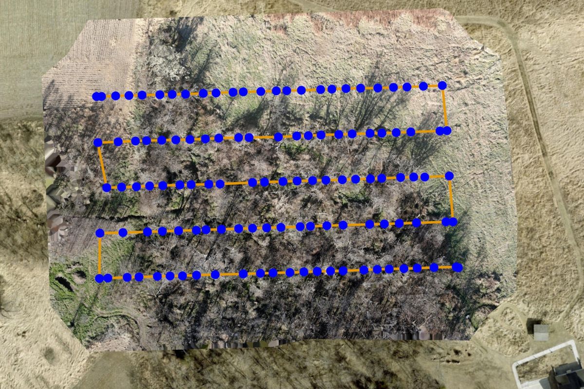
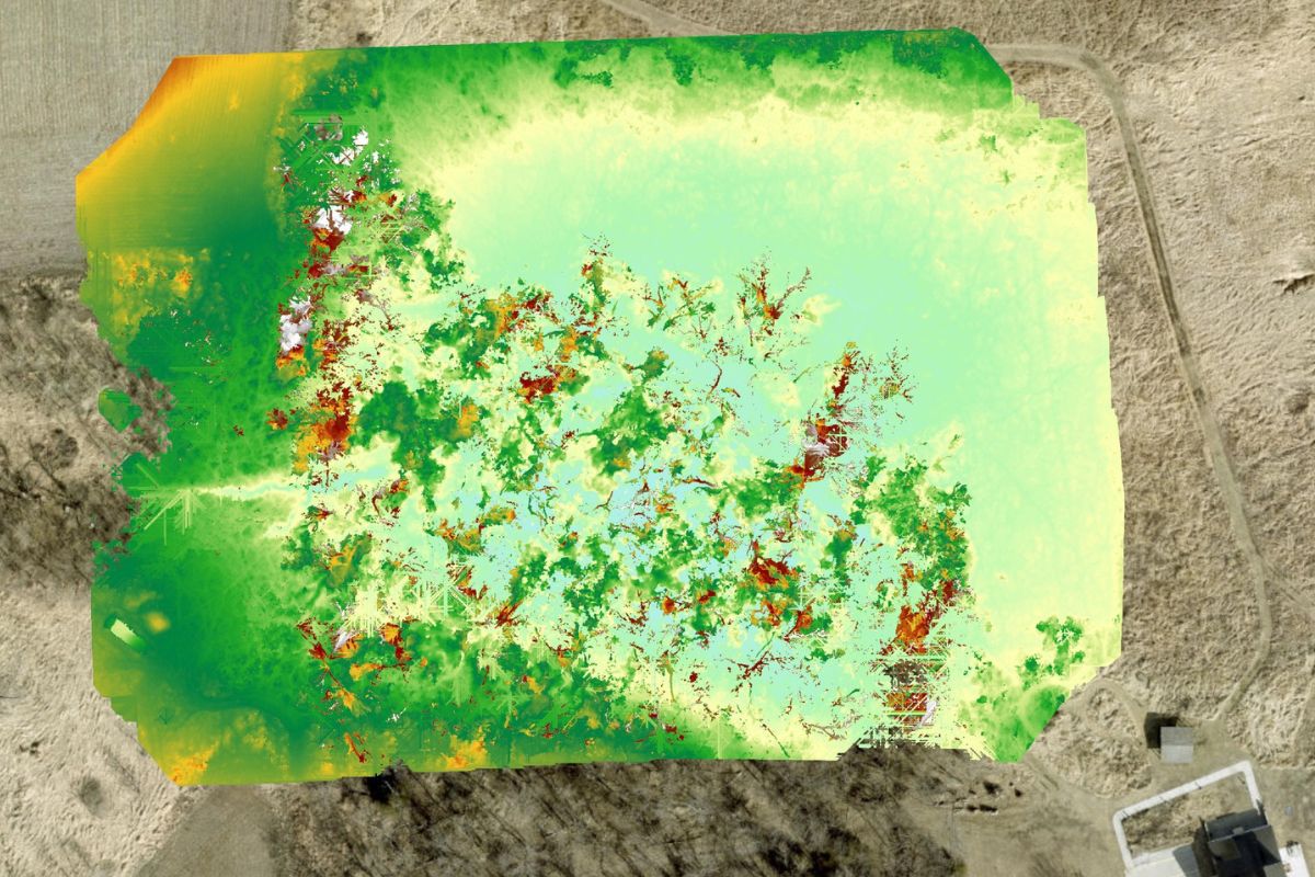
During the drone lab, students conducted survey mapping missions by programming their drones to fly specific routes over designated areas. These flights allowed the aircraft to systematically capture aerial images of the terrain from above. Students then used the images collected during their missions to create high-definition composite photographs, similar to the types of geospatial products used by industries such as construction, agriculture, and environmental research.
The lab also exposed students to the complete operational workflow used in many professional unmanned aircraft missions. Before launching their drones, students programmed flight paths and mission parameters using mapping software. Once the flights were completed, they processed the captured imagery to generate detailed composite maps of the areas the aircraft surveyed.
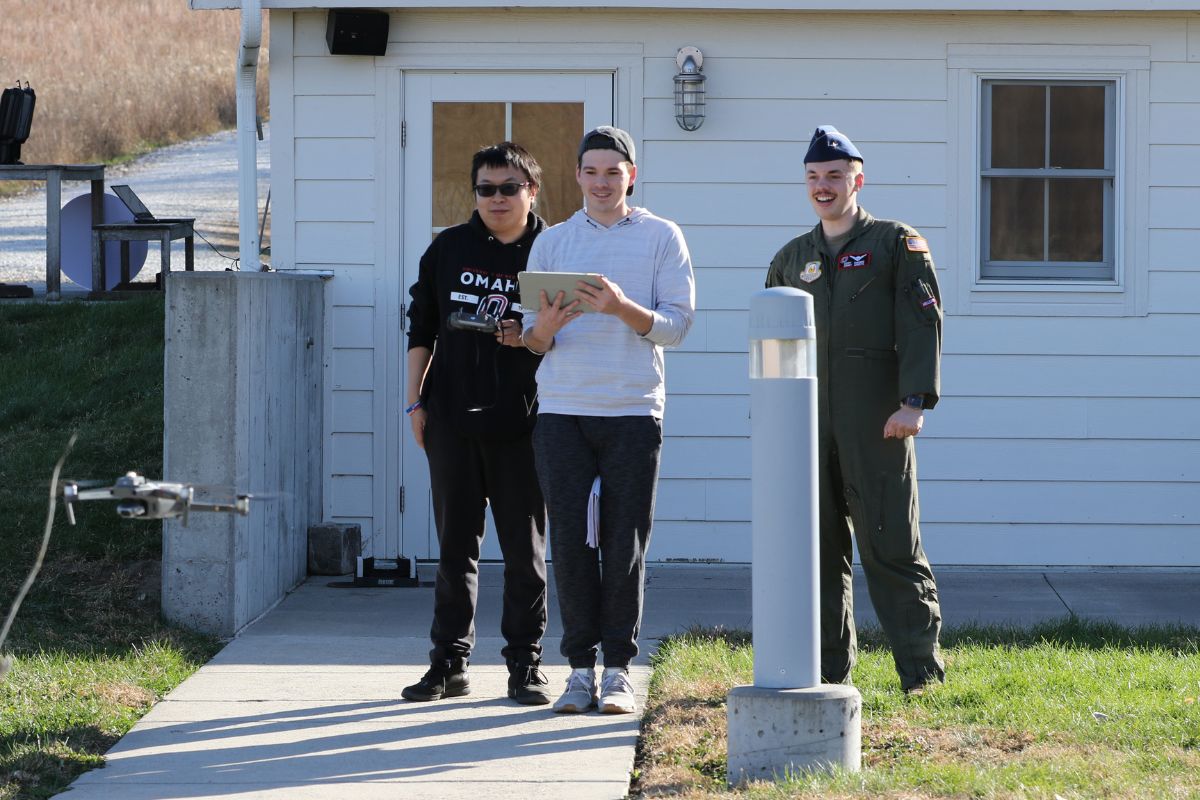
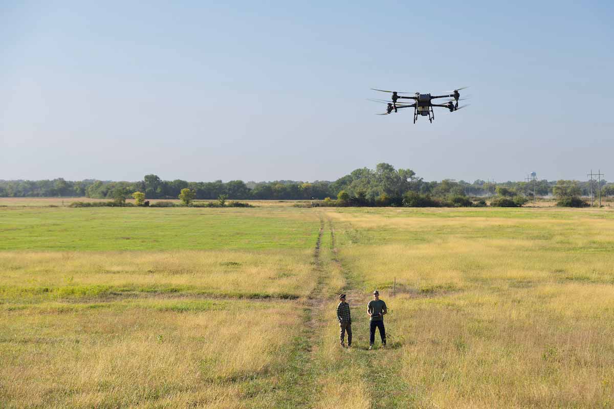
Flights for the class are typically conducted either on the UNO campus or at the Glacier Creek Preserve, a nearby outdoor research and education site that provides open space ideal for flight operations and terrain mapping exercises. The variety of environments allows students to practice drone operations in different conditions while collecting usable aerial data.
By completing the lab, students gain a better understanding of how unmanned aircraft systems are used beyond simple drone flight. The experience emphasizes mission planning, data collection, and post-processing—skills that are increasingly important as industries adopt drone technology for surveying, inspection, mapping, and environmental monitoring.
Through courses like AVN 2500, the Aviation Institute continues to expand opportunities for students to engage with emerging aviation technologies. The drone lab offers a practical introduction to the growing field of unmanned aircraft systems while preparing students for careers that rely on precise aerial data and advanced aviation technology.
Drones Are Everywhere. Hackers Are, Too. UNO is Working to Keep Nebraska’s UAVs Safe
February 2, 2026
As drones become essential to agriculture and public safety, a UNO team is developing AI-powered defenses against cyberattacks that could send them off course.
For more information about the UNO Aviation Institute and its programs, please visit aviation.unomaha.edu.