Distance Learning Module 18 - Glacier Inventory
Glacier inventory is the mapping and measuring of all the glaciers (frozen H2O) in the mountains of a country.
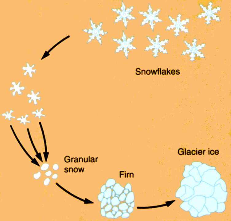
Figure 18.1. Snowfall in the mountains partly melts and recrystallizes over and over to first become granular snow, then to firn, and later after about 5 – 7 years to become glacier ice.
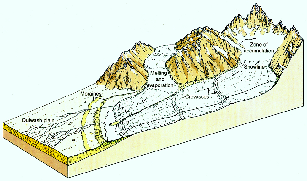
Figure 18.2. Glaciers accumulate in high mountain areas and then slide and flow down to lower elevations where they melt away in the lower ablation zone.
Mapping and measuring glaciers in mountains is difficult because of the high altitude and remote mountainous terrain, with many different kinds of hazards.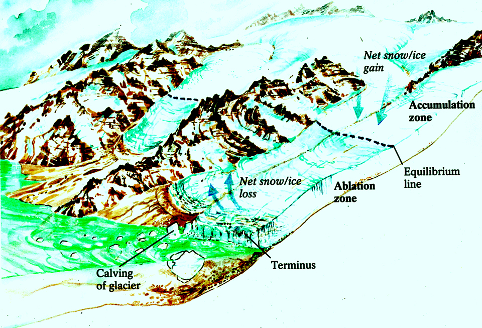
Figure 18.3. Glacier flowing down into a lake where pieces break off or calve.
Why would we bother with such work? Because glacier ice is water in storage that can be used at a later time as the solid ice melts back to liquid water, so it is important.
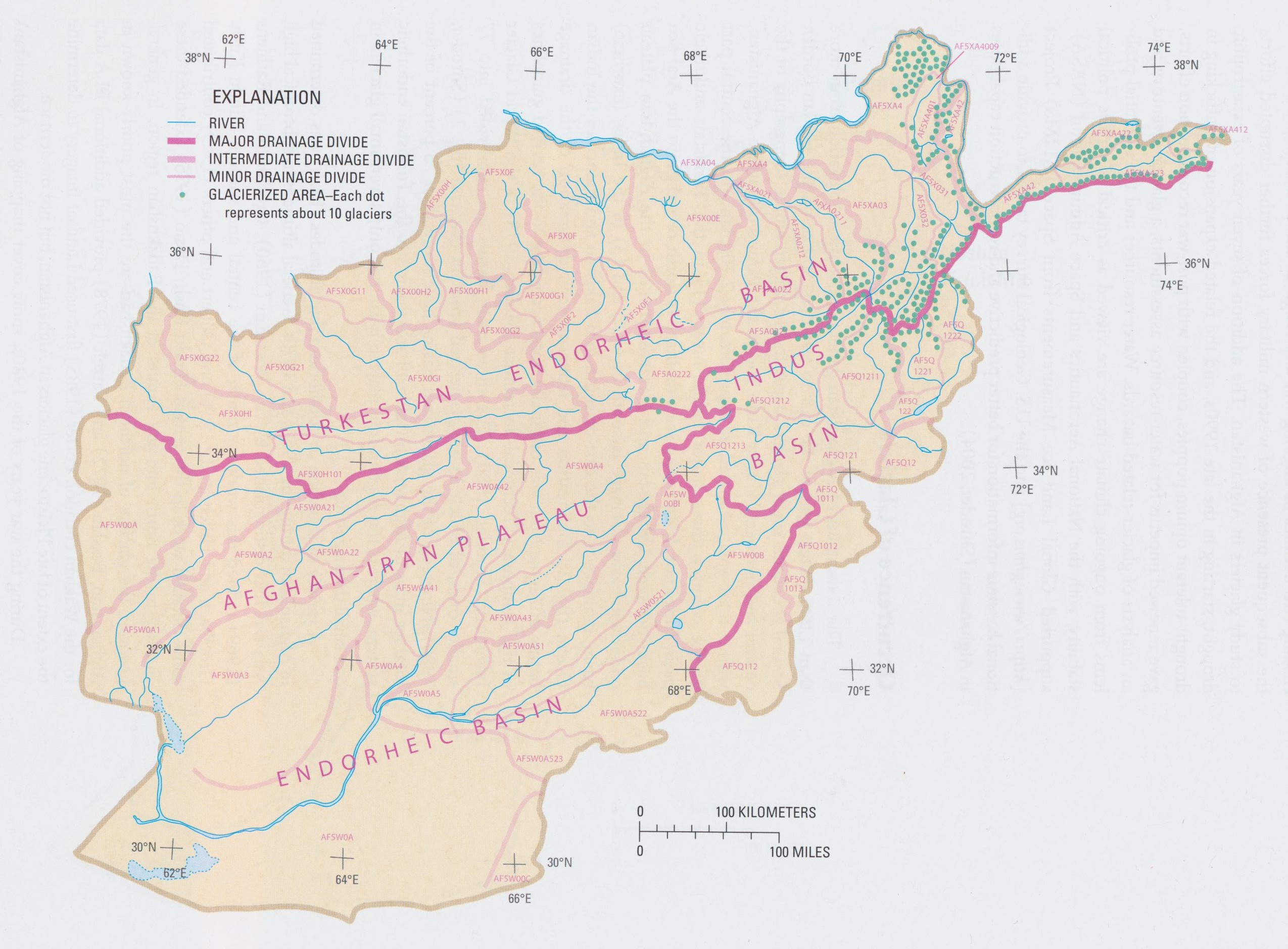
Figure 18.4. Map of Afghanistan glaciers in the three big basins; each green dot represents about 10 glaciers. The endorheic basins are those that do not drain out to the ocean.
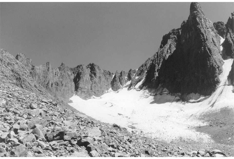 Figure 18.5. Foladi Glacier in the Kohi Baba Mountains near Bamiyan in 1978. This glacier is now much smaller than it was then.
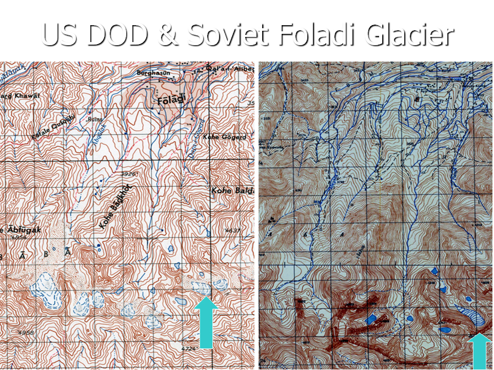
Figure 18.6. Maps of Foladi Glacier made from aerial photographs taken in the early 1960s, when the glacier was much larger. Map on left was made by US Department of Defense and on the right by the Soviet military.
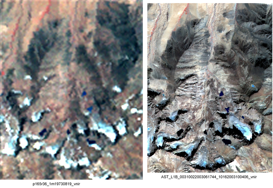
Figure 18.7. Satellite images of Foladi Glacier showing its retreat (Left – August 1973; Right – October 2003).
Figure 18.8. Map of glaciers around Mir Samir Mountain in the Hindu Kush close to the Panshir River as they were in the early 1960s.
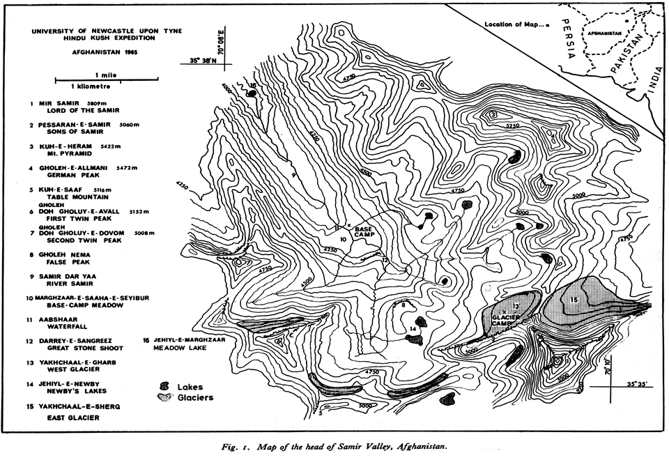
Figure 18.9. Map of the glaciers around the north side of Mir Samir that were first mapped by British mountain climbers in 1965. Glacier number 13 (Yakhchaal-e-Gharb) upon which the mountaineers set up their camp was mapped in the most detail by them.
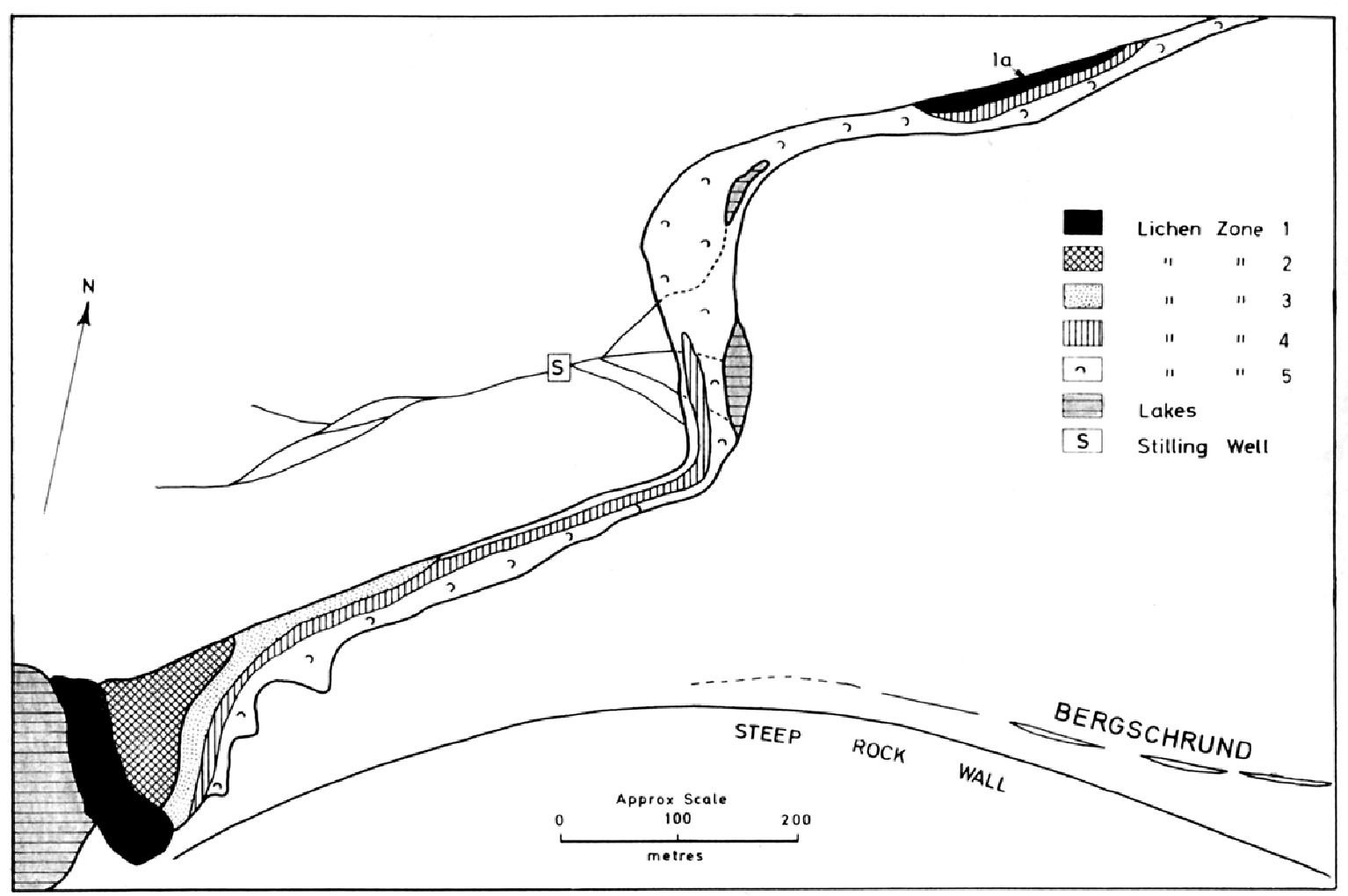
Figure 18.10. Map of glacier #13 (Yakhchaal-e-Gharb) in 1965 showing narrow ice extension to the west that has changed dramatically in the past 50 years and divided this glacier into two because the ice has melted down so much.
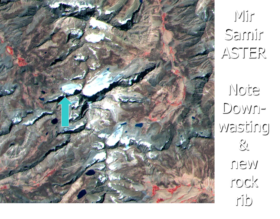
Figure 18.11. ASTER satellite image of 2006 showing how glacier #13 (blue arrow) has wasted downward and exposed the bedrock beneath.
Satellite image interpretation is the best methodology to map glaciers on a regular basis to see if anything is changing that would diminish the amount of melt water coming downstream in future years.
ASTER satellite imagery is the best available imagery for glacier interpretation, but numerous other types exist as well. It is important to see how the balance varies between what snow is coming into the accumulation zone, and melting away in the wastage zone.
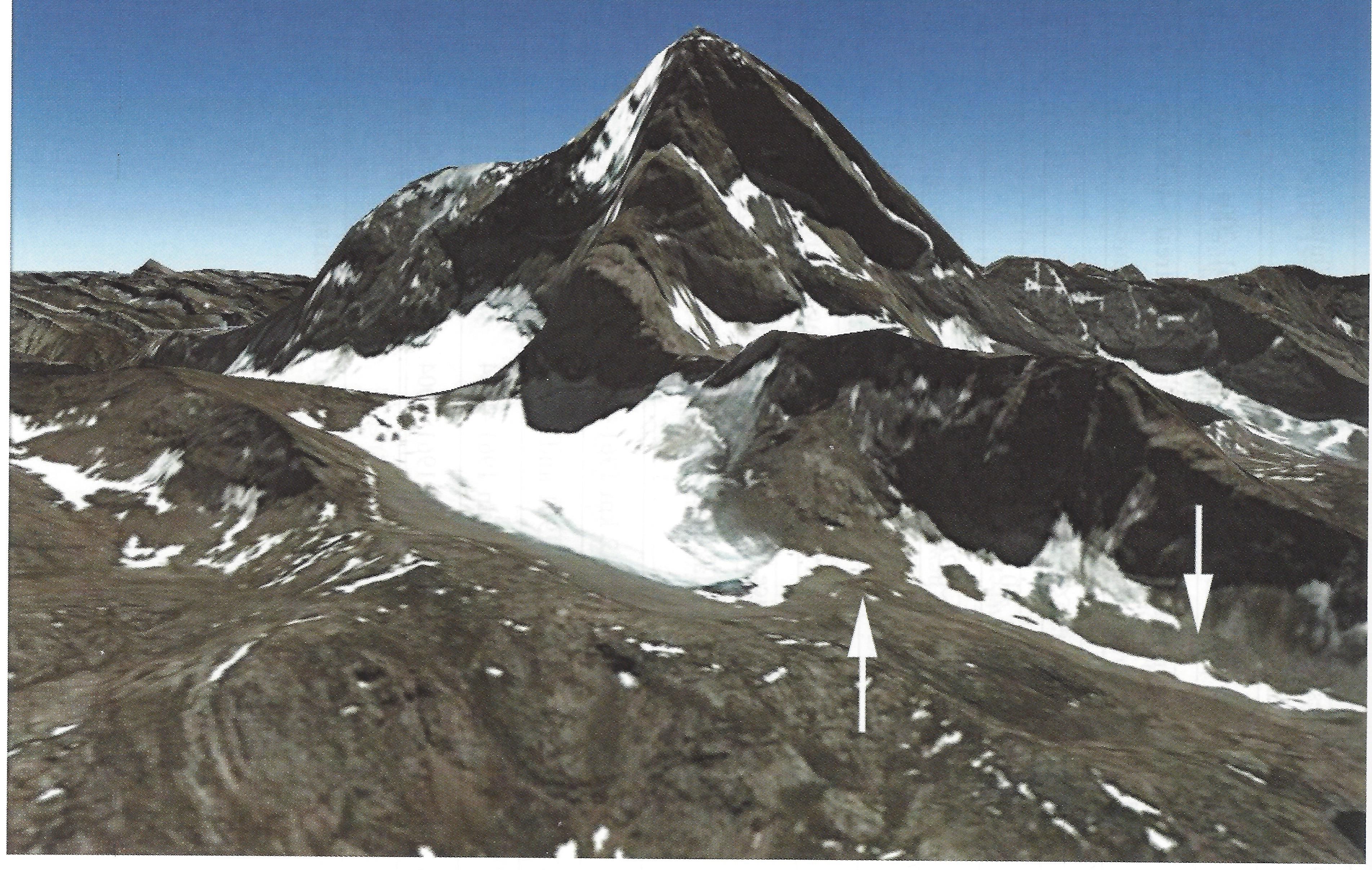
Figure 18.12 Picture looking south made with ASTER satellite imagery of 2006 draped over computer-generated topography of Mir Samir, with glacier #13 (Yakhchaal-e-Gharb) in the foreground. The left arrow shows the new rib of rock that was exposed as the glacier melted down and divided into two.
The annual snowline or equilibrium line is the balance zone between incoming accumulation and outgoing wastage.
The glacier inventory of Afghanistan mountains was done by the GLIMS Regional Center for Southwest Asia (Afghanistan and Pakistan) directed by Drs. Michael P. Bishop and John F. Shroder at the University of Nebraska at Omaha between 2000 and 2014. GLIMS is Global Land Ice Measurements from Space.
The GLIMS Glacier Database for Afghanistan (and surrounding countries) is housed in the National Snow and Ice Data Center (NSIDC) at the University of Colorado, Boulder, CO, USA
Glaciers were mapped 50 years ago in all of Afghanistan, but only a few glaciers in the Kohi Baba near Bamiyan, Mir Samir just south of the Panjshir River, and the Hindu Kush and Great Pamir in the Wakhan Corridor were ever mapped in any detail.
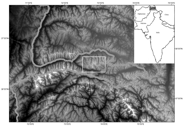
Figure 18.13 Location of Great Pamir Range in the Wakhan Corridor of extreme northeast Afghanistan where glaciers have been studied and mapped in detail in 1975-76 and 2003.
Now all these glaciers seem to be melting down to much smaller sizes, which is reducing melt water downstream and adding to drought problems.
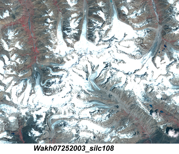
Figure 18.14 ASTER satellite image of Wakhan Pamir glaciers as they were in 2003.
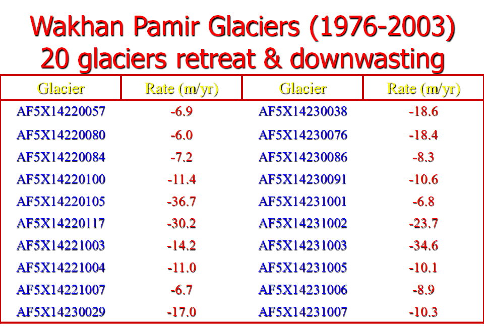
Figure 18.15 Graph showing that all of the glaciers in the Pamir of the Wakhan Corridor have been melting down and their fronts have been retreating an average of -14.88 meters per year.
Additional information about Afghanistan glaciers is available in:
Shroder, J.F., Jr. and M.P. Bishop, 2010, Glaciers of Afghanistan. In: Satellite Image Atlas of Glaciers of the World - Asia, eds. R.S. Williams, Jr. and J.G. Ferrigno, U.S. Geological Survey Professional Paper 1386-F3: 167-199.
Shroder, J.F., Jr. and M.P. Bishop, 2010, Glaciers of Pakistan. In: Satellite Image Atlas of Glaciers of the World - Asia, eds. R.S. Williams, Jr. and J.G. Ferrigno, U.S. Geological Survey Professional Paper 1386-F4: 201-257.
Bishop, Michael P., John F. Shroder Jr., Ghazanfar Ali, Andrew B.G. Bush, Umesh Haritashya, Rakhshan Roohi, Mehmet Akif Sarikaya, and Brandon J. Weihs, 2014, Remote sensing of glaciers in Afghanistan and Pakistan, in: Kargel, J.S., G.J. Leonard, M.P. Bishop, A. Kääb, B. Raup (Eds), Global Land Ice Measurements from Space (Springer-Praxis), Chapter 23, ISBN-10: 354079817X | ISBN-13: 978-3540798170.