Distance Learning Module 11 - River Dams
- Improvement/development of water-resource infrastructure in Afghanistan is driven by optimistic return from 30 years of constant war & damage/destruction of prior infrastructure from 1940s – 1970s.
- Brighter future leads to population expansion (>30 M – 2000; >35 M – 2019; >64 M – 2050).
- Kabul City population (285,000 – 1960; 4.5 M – 2015). Some 74% of Afghans live rural subsistence life, and 60% of total population is agricultural. Agriculture uses some 98% of all water, with 85% coming from major rivers. Annually, only about half of the 12% arable lands are cultivated due to spatially and chronologically limited spring rains and snowmelt. City starved for clean water.
- Kabul River System, with Logar, Ghorband-Panjshir, Kunar tributaries has many plans for dams with help from Indian government, but Pakistan not happy.
- Infrastructure key to development gain, but old “build – neglect – rebuild” will not succeed anymore. Instead new planning must recognize necessity for recognizing: (1) current domestic and agricultural needs; (2) future domestic, agricultural, industrial, and transboundary water needs.
- Current and foreseeable situation in Afghanistan requires multitude of irrigation infrastructure from diversions and small dams to multiple large dams.
- Contentious existing dams include: (1) Salma Dam on Harirud in Herat Province; (2) Kajaki Dam on Helmand River in Helmand Province; (3) Dahla Dam on Arghandab River in Kandahar Province; and (4) Bandi Soltan Dam on Ghaznir River in Ghazni Province.
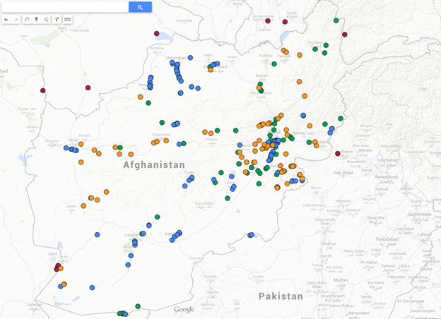
Figure 1. Dams/Diversions/Planned Dams in Afghanistan (green dots-existing, orange-proposed, green-diversions, and red-conterminous dams).
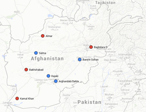
Figure 2. Map of Afghanistan with existing dams (blue dots) and proposed dams.
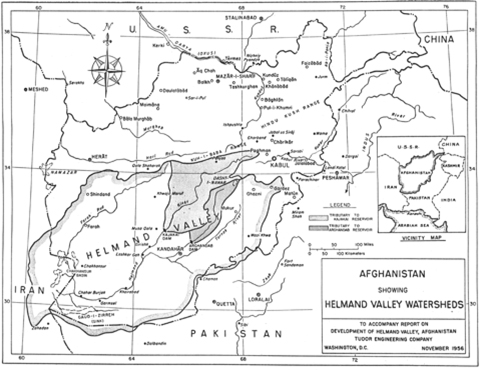
Figure 3. Map of the Helmand Valley watershed (RGA, 1956).
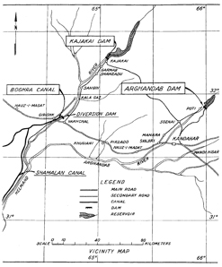
Figure 4. Map of selected projects within Helmand Valley Development Authority (RGA, 1956).
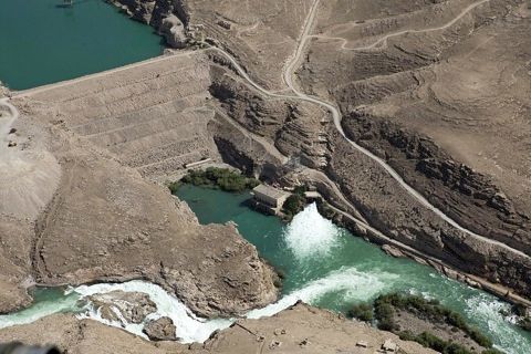
Figure 5. Oblique photographic view of the Kajaki dam showing overflow spillway (bottom of image) and powerhouse release (cryptome.org).
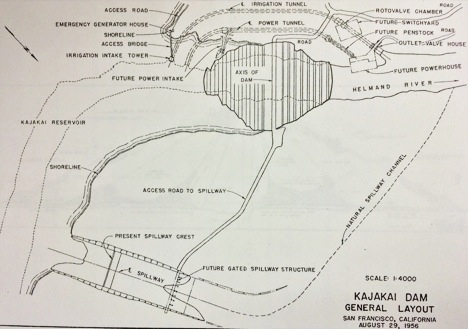
Figure 6. Map of plan for Kajaki Dam.
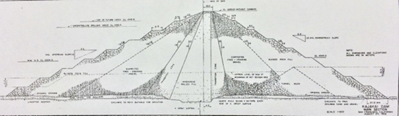
Figure 7. Cross section of Kajaki Dam.
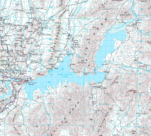
Figure 8. Topographic map of Kajaki Dam.
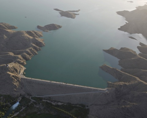
Figure 9. Oblique, aerial view of the Dahla dam and Arghandab Reservoir.
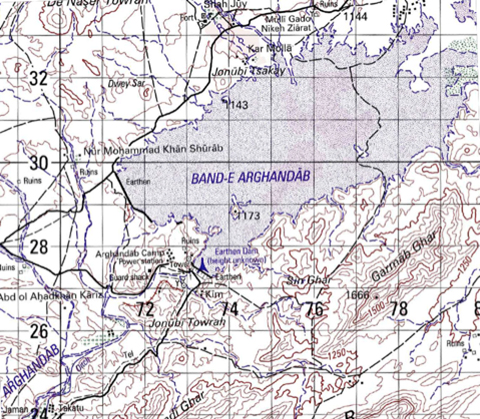
Figure 10. Topographic map of Arghandab Reservoir and Dahla Dam.
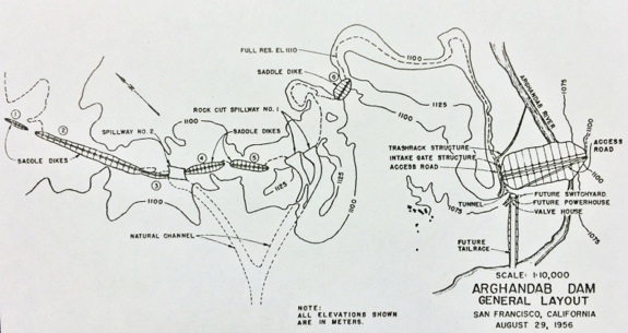
Figure 11. Engineering plan for Arghandab dam plan.
- Salma Dam 150 km east of Herat is 10.8 m-high, earth and rockfill, yet-to-be-closed & filled, hydropower/irrigation dam (0.551 km top length), active capacity 560 million m3.
- Salma Dam originally constructed in 1976, but damaged in Afghan civil war, and reconstructed in 1988 with help from Indian government but left incomplete thereafter. Since 2004 India back with $79 million for more reconstruction so dam not filled.
Figure 12. Salma Dam on the Hari Rud east of Herat.
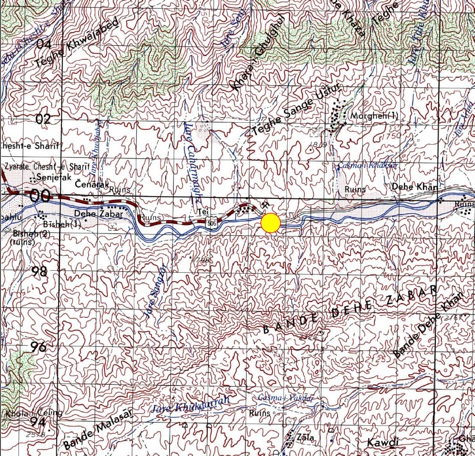
Figure 13. Topographic map of the Salma Dam.
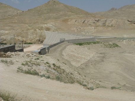
Figure 14. Photograph of Bandi Sultan Dam.
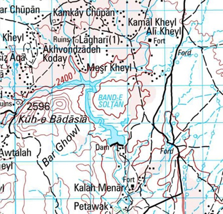
Figure 15. Topographic map of Bandi Sultan.
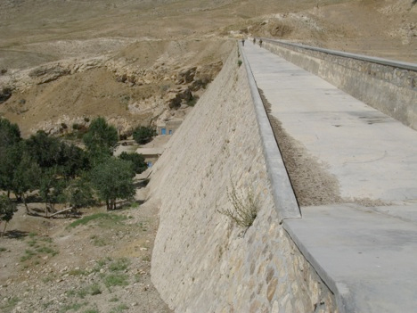 Figure 16. Photo of perspective view along the top deck of the Bandi Sultan Dam.
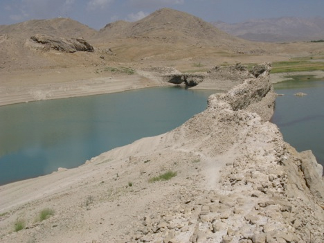
Figure 17. Original, 10th-Century portion of the Bandi Sultan dam, currently submerged by the reservoir. This dam is made of bricks and mortar.
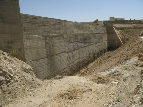
Figure 18. Repaired wing-wall section of the Bandi Sultan dam (Stewart, 2009). This represents 4 years of progress in repairing the dam after the March, 2005 failure.
- Other contentious proposed dams include: (1) Almar Dam on Almar Rud in Amu Darya basin, Faryab Province; (2) Bakhshabad Dam on Farah Rud in Farah Province; (3) Kamal Dam on Lower Helmand River in Nimruz Province; (4) Baghdara Dam on Panjsher River; (5) Some 13 dams planned for the Kabul River and its tributaries.
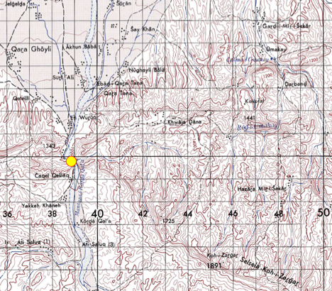
Figure 19. Topographic map (1:100k) of proposed location for the Almar dam site.
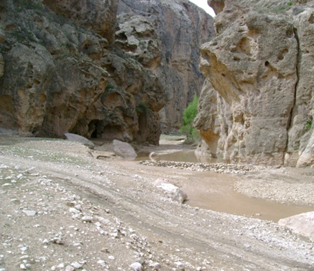
Figure 20. Perspective view looking upstream approximately 300 meters north of the proposed Almar dam site (Opsingh, 2015).
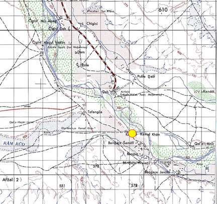
Figure 21. Topographic map of proposed location for the Kamal Khan dam area (yellow dot) on the lower Helmand.
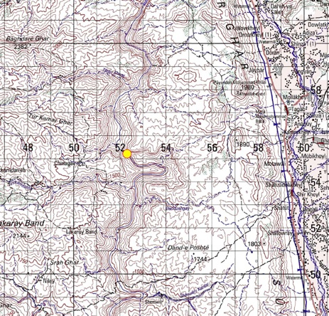
Figure 22. Topographic map (1:100k) of the proposed Baghdara dam (yellow dot) area in the Panjshir River Canyon.
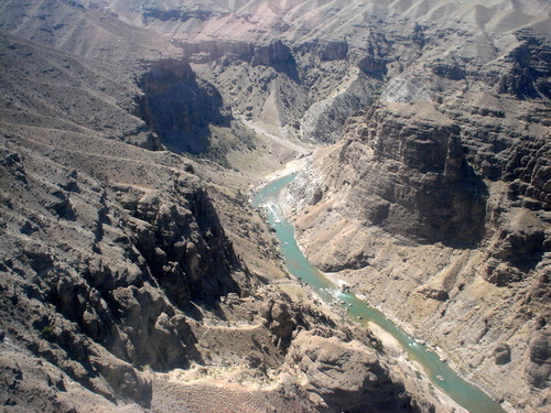
Figure 23. Canyon of Panjshir River NE of Kabul City that will be dammed to provide hydroelectricity and water for the City of Kabul.
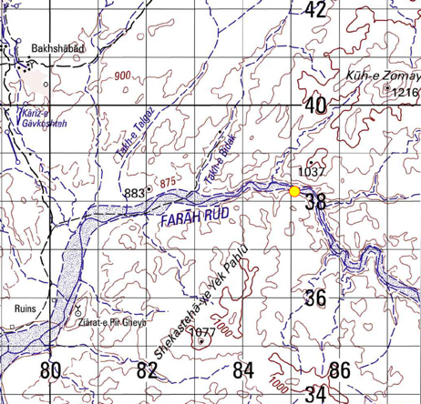
Figure 24. Topographic map (1:100k) of the Bakshabad dam (yellow dot) area on the Farah Rud in the Seistan Basin.
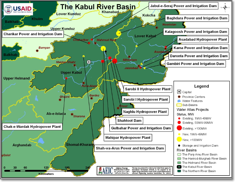
Figure 25. Existing and proposed dams in Kabul River Basin.
- Long-term dam maintenance and dam operation must be guaranteed through educational efforts.
Distance Learning Module #11 Sample Questions